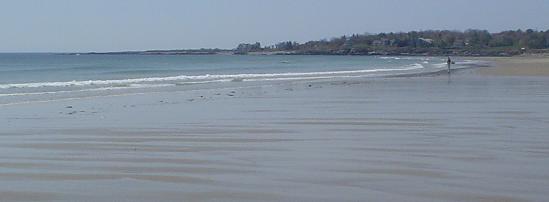
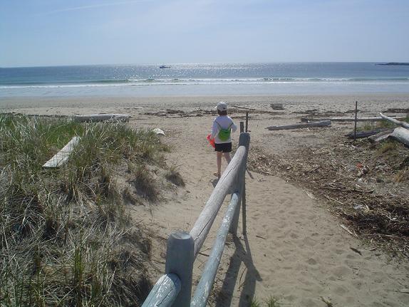
Surprised to find ourselves facing 22° C, we headed to Scarborough Beach south of Portland. This is what happy feet look like in the big ocean: [2.5 MB mpg]. Never had ice cream head ache below the ankles before. Happy kids nonetheless: [2.9 MB mpg].
Category: Places
America
America is grey line on the horizon beyond Wolfe Island to the south east as viewed from the mouth of the Little Cataraqui River. The highlands, beyond Watertown, in the south-east of Jefferson County, New York, fifty some miles away, rise to 1,500 feet and form the western edge of the Adirondacks.
Less Ice, More Water
Wuzza Hot?
 So we are back from being over the border, having had a great time. I took some movies to be posted later of the Battle of Ogdensburg recreation which are fairly neat – if seeing grown men dressed up funny shooting cannon within town limits is cool to you.
But as I was driving through east end Ogdensburg, New York, I noticed this. What is a “Hot” that you could win first prize for? The particular outlet for them is called Whimpy’s Inn.
Battle of Ogdensburg
We are heading over to beautiful Ogdensburg, 100 km down river on the USA side, for the 14th. Beats the hell out of the Valentine’s Day when myself and herself were amazed at the easy access to the coin laundry machines before we remembered the date.
It is not the reopening of the cheese plant that attracts us. No. It’s the nutty recreationists dressing up like 1812 soldiers for the annual Battle of Ogdensburg re-enactment. Here is the contemporary British view of events. Apparently a group of Newfoundlanders were key to the victory. Here is an American perspective. Pretty big battle with 800 redcoats involved on a direct attack on a US village and fort. Here is a map of the battle. Canadian re-enactors as well as US take part. The area had a mid-1700s French presence and only became the USA in 1796 when the British retreated after the Jay Treaty.
Later St. Lawrence University will play host to Vermont at Canton in NCAA hockey – fewer guns but more real fights.
Napanee
Good Planning
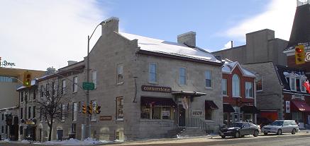
Pub, Art, Hair, Curry, Texmex. I like this block – kitty corner to S&R – which incorporates a 1870’s firehall, some limestones a few decades older as well as a new brick build with a hair place that fits in the scheme. Next to it, tucked behind down the alley to the right is Curry Village, one of the great Indian restaurants in the downtown. Behind to the left you’ll see a Holiday Inn which was built on an old wharf like others in the downtown – rather than on land occupied by historic buildings. At the intersection, Cornerstone is a private art gallery with Inuit art among other things. The 1876 firehall half shown to the right of the picture is a Lonestar. To the left, the newish pub Merchant MacLiam built in the last year or two fills the oldest space in the scene, an 1840 warehouse with a very similar build to Halifax’s Lower Deck with more of a Middle Deck crowd. The pub, curry and texmex all meet in patios at the back with view of the river.
The Barachois is Claimed!
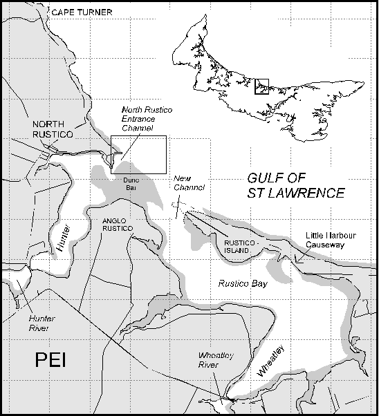 I used to live a walk from the sand bar – or barachois in Acadian French – near North Rustico, PEI which is now being claimed by someone as ownable land. Funny until you remember the bit that is not covered by the tides twice a day is a nesting site for rare plovers. Thank God we can rest easy knowing the top guns are on the case:
Lewie Creed is the deputy minister and says something will be done, he just hasn’t decided yet what that will be.
Beautiful. I have found this handy map and I think the area in question is that identified as “Dune Bar” above Anglo Rustico – that is the bit known locally as the barachois.
It is interesting to note the absence of South Rustico on the map as well as Rusticoville (not to mention Rustico Cross but we won’t get into that one) and the Hunter River is known as the Clyde River at that point of the flow. Hence the name Hunter-Clyde Watershed Group. Hunter River PEI and Hunter Valley Australia, home of plumy reasonably priced red wines, share a common history in that the same group settled each area and one named itself after the other (but I can’t recall which way it went).
Snar
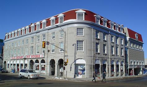
Built largely in 1820 as some kind of markethouse, the S&R Department is a landmark in Kingston, being something of a Margolians of Truro but at the same time selling a broader range of stuff than just clothes and shoes including some groceries, drugs and, up on the top floor, hardware, toys and linens. I don’t know what the “S” and the “R” stands for but in local accent it is pretty much pronounced “snar”. – and just to prove these are the end times, even they have a web site where we find the answer to my question:
The 175 year old limestone building that houses S&R was an integral part of the downtown long before the store came into being more than 40 years ago. It was designed by the same architect as Kingston’s City Hall (George Browne) and constructed in 1817. Among other things, it has been a merchandise mart (1860’s), piano factory (1890’s) and a barracks during W.W.II. S&R was opened in 1959 by Maurice Smith and Percy Robinson after extensive heritage renovations.
157 Years Of 25 Watts Of Power
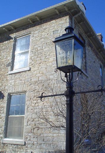
The glass reads “Last Gas Lamp 1847 – 1947.” This is the lamp I referred to the other day. I passed it heading to Queens walking down King Street to do the seminar on section 7 Charter “liberty” and biometric surveillance. It is odd doing public talking when I am not being marked, looking for a client or trying to keep a client out of jail…
Notice that the light is on – that’s the yellow glow behind the 1947.

